
Staying Ahead of Mountain Pass Closures
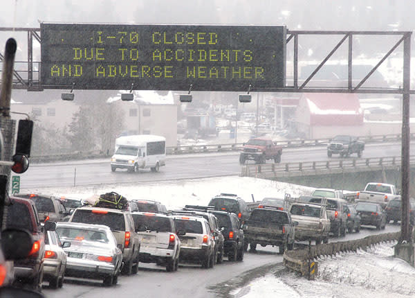
We all know how quickly conditions can change on I-70. One minute, Vail Pass is clear; the next, you're dealing with a closure that throws off an entire day's schedule: guest arrivals, employee shifts, event logistics. As a transportation provider operating in the Vail Valley since 2012, staying ahead of these conditions isn't just convenient for us at Blue Sky Limo, it's essential for the safety of our clients and the reliability of our service.

When Vail Pass closes unexpectedly, the Eisenhower Tunnel backs up for miles, or Glenwood Canyon shuts down due to rockfall, we need to know immediately so we can adjust routes, communicate with clients, and make informed decisions about whether to depart or wait it out. CDOT provides abundant, valuable information on COtrip.org, and many travelers rely on its advisories for safe mountain travel. However, we needed something more: a central dashboard, scoped specifically to the mountain passes serving our valley, where all the critical data for a given corridor is available in one place rather than scattered across multiple CDOT tools.
Building a Data-Driven Solution for Safe Mountain Travel
Rather than clicking through multiple CDOT pages trying to piece together a complete picture, we decided to tap directly into CDOT's official API and build our own real-time road conditions dashboard. We created it for our operations, but quickly realized this resource could benefit the entire Vail Valley community. Whether you're coordinating guest arrivals, managing staff commutes, or planning event transportation, we've made these tools publicly available at: https://blueskylimovail.com/road-conditions for anyone to use.
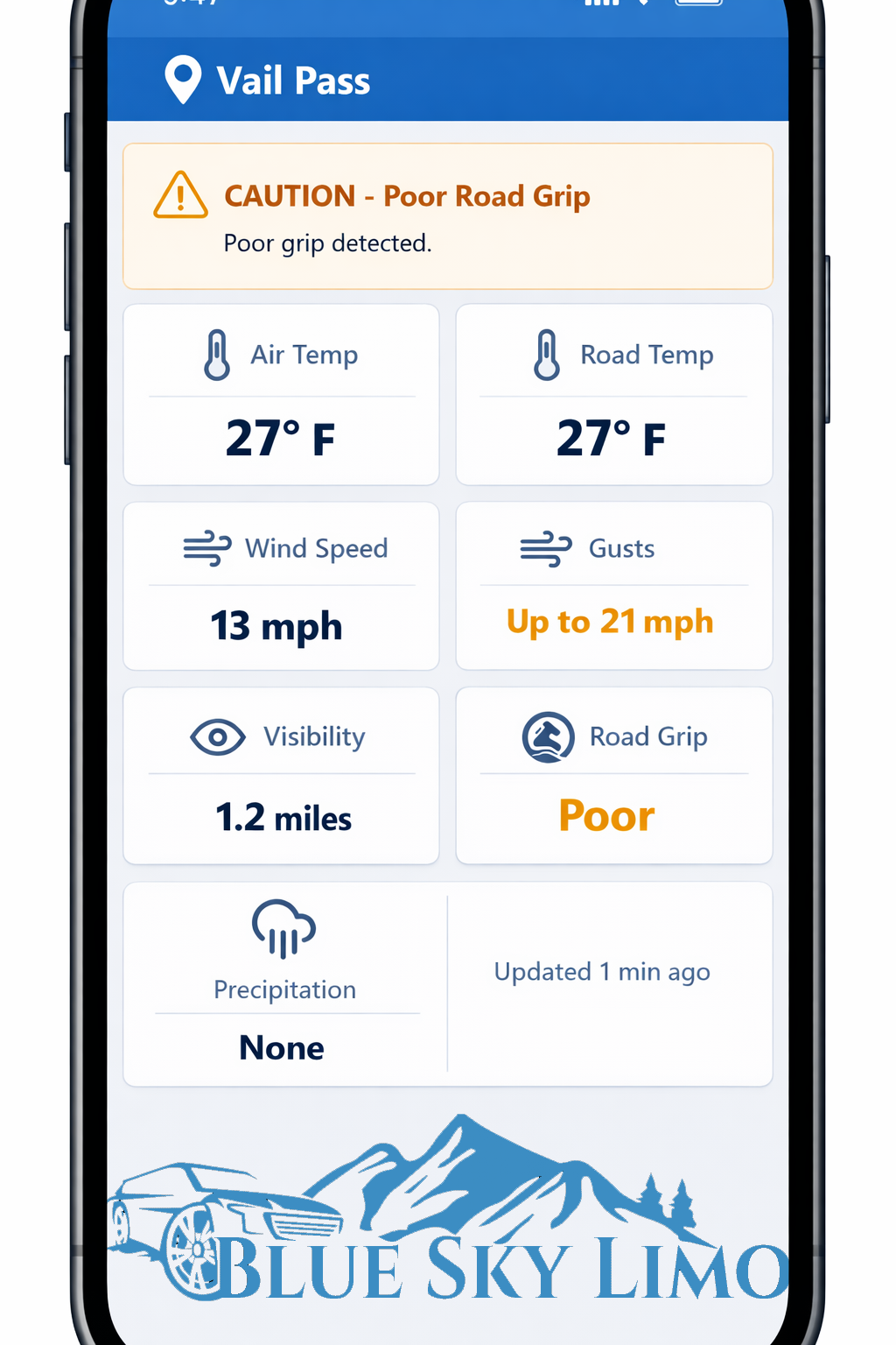
The system pulls live data from six different CDOT endpoints every five minutes: incidents, digital message signs, weather stations, road surface sensors, traffic delays, and planned construction. Instead of presenting raw government data, we aggregate and filter everything through specific mountain pass corridors and present it in a simple, actionable format. Our Vail Pass dashboard, for example, scans the entire I-70 corridor from milepost 180 to 203, monitors all relevant data sources, and calculates an overall status: Open, Restricted, Severe, or Closed.
Essential Colorado Road Condition Information
When you're deciding whether to travel, delay your departure, or adjust your route, having complete information matters. Each of our mountain pass-specific pages consolidates critical data that would otherwise require visiting multiple CDOT resources:
- Road surface conditions - Dry, wet, icy, slushy, or snow-covered pavement based on actual CDOT sensor data
- Road grip and traction ratings - Measured friction coefficients from pavement sensors
- Current weather data - Temperature, visibility, wind speed, and active precipitation at multiple stations along the corridor
- Chain law status - Real-time alerts for passenger vehicle and commercial vehicle chain requirements
- Open/closed status - Clear severity indicators (Clear, Caution, Severe, Closed) based on current conditions
- Live traffic cameras - Embedded feeds positioned at key points so you can see conditions visually
- Travel time comparisons - Current versus normal travel times to identify building delays
- Active incidents - Crashes, closures, and hazards affecting the corridor
- Digital sign messages - Cleaned and formatted alerts from CDOT message boards
- Construction and maintenance - Planned events that may impact travel
For example, knowing that Vail Pass is "open" but the road surface is "icy" with "poor" traction and "active snowfall" gives travelers a much clearer picture than a status indicator alone. Our I-70 Mountain Road Report provides this same comprehensive view across the entire mountain corridor.
Additional Pages for Other Critical Mountain Corridors
Beyond Vail Pass, we've created dedicated dashboards for the other chokepoints that define access to our valley. Our page for Eisenhower Tunnel status monitors the corridor under the Continental Divide, while our page for Glenwood Canyon road conditions tracks this geologically complex and closure-prone stretch west of the valley.
The system also includes dedicated pages for Loveland Pass, Berthoud Pass, Independence Pass, Hoosier Pass, and the full I-70 Mountain Corridor. Whether your guests are driving themselves or using our private shuttle services, having access to pass-specific intelligence helps everyone make safer, more informed travel decisions.
A Resource for the VVP Community
To our fellow Vail Valley Partnership members: we encourage you to use these tools with your guests, clients, and teams. Include links in pre-arrival emails, reference them at the front desk when visitors ask about road status, and share them with staff during challenging weather. The data refreshes every five minutes from CDOT's live feeds, and pages are mobile-optimized for checking conditions on the go.
For partnership opportunities or questions about how we can support your guest experience, reach out at info@blueskylimovail.com or call 970-376-7849.
Stay safe out there!
Images
Additional Info
Organization Name : Blue Sky Limo LLC